

3/4 Bedroom House - High Wycombe
High Wycombe
£1,595 pcm
4 x
1 x
1 x
Department:
Lettings
Reference:
Thara 87165
Postcode:
HP12 4PG
Type:
Semi-Detached House
Marketing Flag:
Recently Let
Availability:
Let Agreed
Receptions:
1
Furnished:
Part Furnished
Deposit:
£1,595
Available Date:
2024-03-12
Council Tax Band:
D
Summary
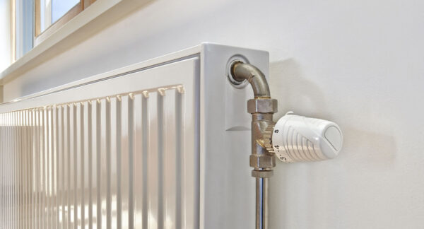
Thara Properties Sales & Lettings are proud to present this spacious 3/4 bedroom semi-detached house with parking available on an unfurnished basis. The property is located on cressex road and easy access to M40 J4 . The accommodation comprises; Entrance hall, modern fitted kitchen, utility area, large lounge and separate dining room, three bedrooms and family bathroom. The property further benefits from; UPVC double glazing, gas central heating, private rear garden and ample block paved driveway parking.EPC Rating D (Bucks Council) Council Tax Band D
Rent £1595.00 Deposit £1595.00
Holding Deposit (per tenancy): One week’s rent. This is to reserve a property. Please Note: This will be withheld if any relevant person (including any guarantor(s)) withdraw from the tenancy, fail a Right- to-Rent check, provide materially significant false or misleading information, or fail to sign their tenancy agreement (and / or Deed of Guarantee) within 15 calendar days (or other Deadline for Agreement as mutually agreed in writing).
Ultrafast / Gigabit Broadband (300+ Mbps)
Strong Indoor & Outdoor 4G / Voice (All Providers)
Based on average Indoor & Outdoor data from the Local Authority
Nearest Local Schools & Transport Links
| School Name | Age | Distance | |
|---|---|---|---|
| Chepping View Primary Academy | 4-11 | 0.1 mi | |
| Kite Ridge School | 11-19 | 0.2 mi | |
| Chiltern Wood School | 3-19 | 0.2 mi | |
| John Hampden Grammar School | 11-18 | 0.3 mi | |
| Wycombe High School | 11-18 | 0.5 mi | |
| Cressex Community School | 11-18 | 0.6 mi | |
| St Michael's Catholic School | 3-19 | 0.7 mi | |
| Castlefield School | 2-11 | 0.8 mi | |
| Booker Hill Primary School & Nursery | 3-11 | 1.0 mi | |
| Oakridge School | 2-11 | 1.0 mi |
| Station Name | Distance | |
|---|---|---|
| High Wycombe Rail Station | 1.5 mi | |
| Marlow Rail Station | 3.1 mi | |
| Bourne End Rail Station | 3.7 mi | |
| Cookham Rail Station | 4.6 mi | |
| Saunderton Rail Station | 4.8 mi | |
| Beaconsfield Rail Station | 5.5 mi | |
| Furze Platt Rail Station | 6.0 mi | |
| Great Missenden Rail Station | 6.6 mi | |
| Maidenhead Rail Station | 7.0 mi | |
| Seer Green Rail Station | 7.1 mi |
| Bus Stop Name | Distance | |
|---|---|---|
| o/s 9 - Cressex Road East | 0.1 mi | |
| Opp 3 - Cressex Road East | 0.1 mi | |
| adj - Verney Avenue | 0.1 mi | |
| o/s 73 - Marlow Road | 0.1 mi | |
| Opp - Verney Avenue | 0.1 mi | |
| opp 61 - Marlow Road | 0.2 mi | |
| o/s - Empire Cinema | 0.2 mi | |
| Next | 0.2 mi | |
| Eastbound - John Hall Way | 0.2 mi | |
| adj - Rupert Avenue | 0.2 mi |
| Airport Name | Distance | |
|---|---|---|
| London Heathrow Airport | 16.8 mi | |
| London Luton Airport | 24.9 mi | |
| London Oxford Airport | 27.6 mi | |
| London City Airport | 36.2 mi | |
| Biggin Hill Airport | 39.9 mi | |
| London Gatwick Airport | 41.2 mi | |
| London Stansted Airport | 48.2 mi | |
| Southampton Airport | 52.6 mi | |
| Cambridge Airport | 57.6 mi | |
| Shoreham Brighton City Airport | 58.0 mi |